|
The Pennyrile WestPark Industrial Park is an 800+ acre industrial mega-site located in Western Kentucky in Lyon County. Pennyrile WestPark is a prime site targeted to a single large industrial client and has all utilities including natural gas located on the site. This mega-site is one of the largest industrial sites available in Kentucky and is “shovel-ready”.
The site consists of 500 acres owned by the Commonwealth of Kentucky with the remaining 300+ acres being privately owned and held under option by the Pennyrile WestPark Industrial Development Authority, the organization responsible for the marketing and development of the site. This organization is a five county regional consortium consisting of Caldwell, Lyon, Crittenden, Trigg, and Livingston Counties. The labor market for the Pennyrile WestPark includes most of Western Kentucky and also extends into Indiana, Illinois, and Tennessee.
The Pennyrile WestPark is strategically located at the junction of Interstate 24 and the Wendell Ford Western Kentucky Parkway, which is designated as Future Interstate 69. Rail and port access is also near the site.
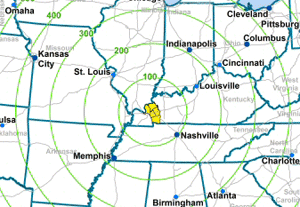
This website provides quick, relevant information regarding the Pennyrile WestPark. Potential clients and site selection consultants are invited to access the maps, studies, and other detailed information available on this premier industrial mega-site located within a day’s drive of over 70% of the US.
|